


The Colporteur
Randonnée pédestre
Duration
Distance
Elevation gain
This short 3-day itinerary links two medieval towns. Starting in St-Ursanne (Switzerland), most of the trail is in Switzerland, then you follow the border over the “Clos du Doubs” valley to reach St-Hippolyte (France) at the confluence of the Doubs and Dessoubre rivers. A host of surprises await you, including a magical woodland, a prehistoric park, caves and spectacular views. You can visit the pliers museum in Montécheroux, a town that has exported famous tools all over the world.
Until the 18th century, the Colporteurs transported a wide range of products, fabrics, lace and books from village to village in wooden boxes carried on their backs
Highlights
- The two medieval towns
- The ridge walk
Access
The return journey to St-Ursanne can be made by taxi or BlaBlaCar (30 minutes). Alternatively, you can do the trail in the opposite direction, in which case you should allow an extra 3 days.
Starting point - Saint-Ursanne

Saint-Ursanne Seleute (Switzerland)
Duration
Distance
Elevation gain
This short stopover allows you to take your time and visit this town with its remarkable historical heritage, including the collegiate church and cloister dating from the 12th and 13th centuries, the narrow streets of the town and the medieval garden with its medicinal plants. You then head for the Col de la Croix to admire the rugged terrain of this small part of Switzerland. You finally reach Seleute after walking along the ridge.
To discover along the way
- Saint-Ursanne et la porte St Pierre
A few steps from the trail
-
La Chapelle de Plainmont

Seleute Réclère (Switzerland)
Duration
Distance
Elevation gain
From Seleute you have to climb back up to the ridge to continue your walk towards the border. You cross the Vallée d’Or, so named because of the white gold, salt, which is heavily taxed by the Gabelle and therefore inevitably smuggled. You will pass by the ruins of the Château de la Roche d’Or. Stop off at the Faux d’Enson tower for a 360° panoramic view and finish off with a visit to the Réclères caves and its prehistoric park.
To discover along the way
- Les bornes frontières
- La tour d’observation de la faux d’Enson
A few steps from the trail
-
Les ruines du Château de Roche d’Or (1000m)

Réclère (Switzerland) Saint-Hippolyte (France)
Duration
Distance
Elevation gain
From Réclère you follow the border along the ridge, before reaching Montécheroux, which was internationally renowned for the manufacture of tools for the watchmaking and medical industries. The path then skirts the rocky ridge overlooking St Hippolyte. You then come to the Grotte du Bisontin, a magnificent karstic arch that is said to have been a smuggler’s lair. It’s a magical place! Then you finish your tour in Saint-Hippolyte, a small medieval village at the confluence of the Doubs and Dessoubre rivers.
Warning! There are no resupply points along the route.
To discover along the way
- Musée de la Pince
- Chapelle Notre-Dame du Mont
- La cabane de douanier à Chamesol
- Le coeur médiéval de Saint Hippolyte
- L’arche du Bisontin
A few steps from the trail
-
Le Fort du Lomont (1200m)
-
Les ruines du château de Montjoie ( 210m d+) (1000m)
-
Le château et la grotte de la Roche (3000m)
End point - Saint-Hippolyte
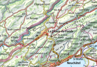
Map
Markings

Common markings along the entire trail
In France
Régional GR® 5


In Switzerland

View map
Download the GPX file
Download the game guide