


The Gabelous
Randonnée à vélo
Duration
E-bike duration
Distance
Elevation gain
This 7-stage route starts in Morteau (France) or St-Ursanne (Switzerland). It runs along both sides of the border, with the Doubs never far away. It’s a fairly easy route, with some steep gradients. Along the way, customs huts have been restored or rebuilt. You’ll pass the emblematic site of the Saut du Doubs. Each stage is a source of discovery, not only for the scenery, with its many viewpoints, but also for its heritage and history, such as the dams and the watchmaking town planning that is a UNESCO World Heritage Site.
The customs officers who guarded the border and tracked down smugglers were known as “Gabelous”.
Highlights
- Le Saut du Doubs
- The Franco-Swiss village of Goumois
- The medieval town of St-Ursanne
- Les Échelles de la Mort, the dams, the tuyé farms.
Access
Morteau station (fr) or St Ursanne station (ch)
Starting point - Morteau

Morteau (France) Chaux-du-Milieu (Switzerland)
Duration
Distance
Elevation gain
You set off from the Morteau campsite along the Doubs plain towards Grand’combe Châteleu. The route follows that of the GTJ VTT as far as Combe Benoit. From there, it joins the border at Bredot and descends into the Brévine valley, where a record cold of minus 41.8°C was recorded in 1987! Every year in February, the cold weather festival is a picturesque institution around the Lac des Taillères, a natural ice rink that is very popular with the locals. It’s also an ideal spot for a bucolic swim in fine weather. You then make your way to the small village of La Chaux-du-Milieu, passing by some beautiful farmhouses.
To discover along the way
- Ferme-Musée Grand’Combe-Châteleu
- Les fermes à tuyé (grande cheminée où sont encore fumés les salaisons)
A few steps from the trail
-
Le Lac des Taillères à la Brévine (800m)

Chaux-du-Milieu Chaux-de-Fonds (Switzerland)
Duration
Distance
Elevation gain
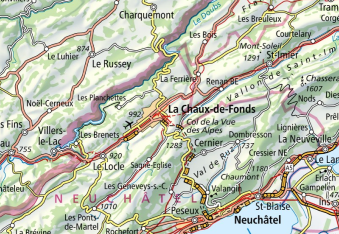
This stage leads to Le Locle, a town with a watchmaking heritage, where you can admire monumental street art frescoes on the theme of time: https://exomusee.ch/ You then reach Les Brenets and follow the banks of the Doubs to the Saut du Doubs and the Chatelot dam. Shortly afterwards, you climb back up to Les Planchettes and the côte de l’Escarpineau, which still offers fine views over Lac de Moron. The route continues through the mountain pastures to reach the town of La Chaux-de-Fonds, whose watchmaking town planning is also a UNESCO World Heritage Site.
To discover along the way
- Les bassins et le Saut du Doubs
- Le barrage du Châtelot
- Le point de vue de l’escarpineau
- Les fresques de street art au Locle https://www.lelocle.ch/loisirs-manifestations/culture/sreet-art/
- Le musée de l’horlogerie de la Chaux-de-Fonds
- La villa Le Corbusier à la Chaux-de-Fonds

Chaux-de-Fonds Goumois (Switzerland)
Duration
Distance
Elevation gain
You will cross the wooded pastures characteristic of the Franches-Montagnes, where horses and herds of cows graze freely. Not far from Goumois, in an idyllic setting, are the Theusseret waterfalls. Before descending to Goumois, you can make a short diversions to the Sommêtres ridge refuge, where you can admire this beautiful rocky limestone ridge stretching for a kilometre, a paradise for rock-climbers.
To discover along the way
- Le musée paysan au Boéchet
- Le centre de chevaux de “Maison Rouge”
- L'arête rocheuse des Sommêtres
- Le barrage de la Goule

Goumois Saint-Ursanne (Switzerland)
Duration
Distance
Elevation gain
You leave the village of Goumois nestling in the hollow of a valley, which has the distinction of straddling the two countries. It is surrounded by high limestone cliffs, including the famous tête de singe. You climb gently towards Pommerat. If you are brave enough, you can leave Pommerat and walk the 3.5 km to discover the geological curiosity of Château Cugny with its collapsed rocks. You then have to retrace your steps to reach Saint-Ursanne, a medieval town full of treasures.
To discover along the way
- Le village des Enfers
- La roue de Bollement à Saint-Brais et son histoire politique
A few steps from the trail
-
Le château Cugny (7000m)

Saint-Ursanne (Switzerland) Fessevillers (France)
Duration
Distance
Elevation gain
You leave Saint-Ursanne by following the Doubs for 7 km, then the path rises to reach the Epiquerez ridge and its beautiful viewpoints. You return “to” France, “as we say here” via the Chaufour and you reach Fessevillers, whose church with its lava roof (flat stones) houses the tombs of the master glassmakers of the Clos du Doubs. These industries were numerous on both sides of the Doubs, benefiting from the motive power and the abundance of wood. Some of the sand, silica essential to glassmaking, came from nearby Le Noirmont in Switzerland.
To discover along the way
- L’Eglise de Fessevillers
- La Chèvrerie de l’Eldorado à Indevillers
- Les Bornes Frontières dont certaines ont été détruites à la révolution

Fessevillers Fournet-Blancheroche (France)
Duration
Distance
Elevation gain
This penultimate stage is quite sporty at the end, with a steep climb. In the heart of nature, you’ll come across the customs huts, pass through one of France’s smallest villages, Urtière, with just 10 inhabitants, and cross the Col de la Vierge at 962 metres. Then it’s down into the Vallée de la Mort and its famous ladders! (Don’t worry, the path passes over them…) but you can put the bike down to use them and shiver as you imagine the smugglers descending the rudimentary old wooden ladders with an animal on their back! After this stopover, head back up to Fournet-Blancheroche.
To discover along the way
- Les Échelles de la Mort
- Belvédère la Cendrée
- La chapelle Saint Roch d’urtière
- Le belvédère des échelles de la mort
- Le site ludique VTT de la Combe St Pierre
A few steps from the trail
-
Le Barrage du refrain

Fournet-Blancheroche Morteau (France)
Duration
Distance
Elevation gain
This is the last stage, and it’s a very easy one, taking you back to your starting point in Morteau. The route is pastoral, passing through fields grazed by Montbéliard cows whose milk produces the famous Comté cheese. Along the way, you’ll pass by the local “fruitières”, cooperatives that collect the farmers’ milk every day and process it to produce beautiful 40 kg wheels. A must-taste, and why not take it home with you – not the whole cheese, but a set, so it’s lighter in your rucksack!
To discover along the way
- La ferme auberge des Louisots du 16ème siècle et son magnifique et atypique tuyé en pierre
- Les grandes gentianes jaunes dans les prés : si elles sont hautes, on dit qu’il y aura beaucoup de neige en hiver.
- Les fruitières

